Valencia Airport (VLC)
City Orientation and Maps
(Valencia, Spain)
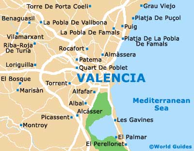
Valencia is located on the centre of Spain's eastern coast, directly west of the Balearic Islands. Many popular towns and cities lie within easy driving distance of Valencia, including Sagunta and Castellón de la Plana to the north, Alicante and Elche to the south, and both Burjassot and Paterna to the west, near to Valencia Airport (VLC).
One of the most popular cities close to Valencia is Barcelona, next to Tarragona. Barcelona is around 345 km / 214 miles from Valencia and can be reached in just over three hours. Also worth noting, the capital city of Madrid is located a similar distance inland and to the west of Valencia.
Valencia Airport (VLC) Maps: Important City Districts
For the heart of the action in Valencia city, head to the oval area, which is edged by the Calles de Colón and the gardens of Rio Tuira, where the river once ran. Here you will find three large public squares, the Plaza del Ayuntamiento, the Plaza de la Reina, and the Plaza de la Virgen. The most historic part of Valencia lies nearby and is known as the Barrio de Carmen.
Valencia's train station is referred to locally as the Estación del Norte and is just a short distance from the city centre, being located close to the Plaza del Ayuntamiento. The city's bus station can be found along the Avenida Menéndez Pidal, next to the riverbed, with regular buses operated by both AutoRes and Alsa.
Spain Map

Valencia Map